Update as of 3:30 PM Monday March 7, 2016
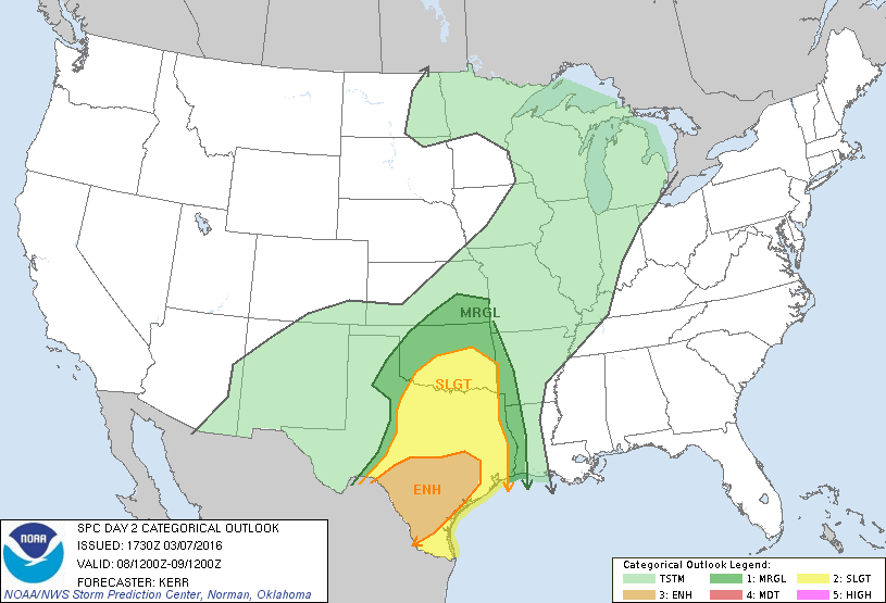
SPC Outlook as of 3 PM 3-7-16
There will be a SLIGHT chance of severe thunderstorms across North Texas on Tuesday (March 8) afternoon/evening. The SPC has issued a Level 2 SLIGHT risk.
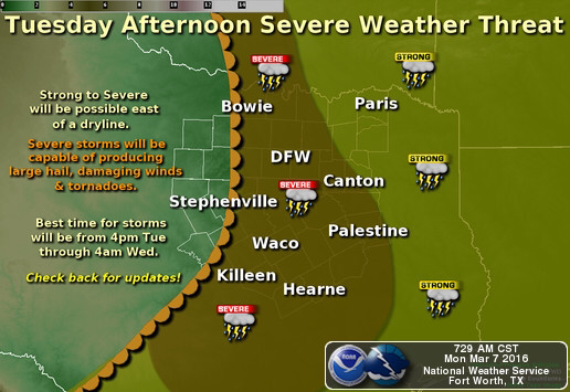
Image courtesy: NWS Fort Worth, TX
Via NWS Fort Worth, TX: A threat for severe weather will continue on Tuesday as a dryline mixes eastward towards North and Central TX. Strong to severe storms are expected to develop late in the afternoon and the severe weather potential will last through the overnight hours. The main hazards with storms will be large hail, damaging winds and a few tornadoes. Some instances of flooding will also be possible as well! Check back for updates!
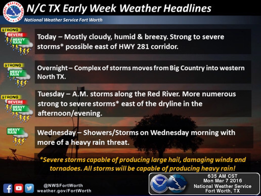
Weather headlines for this week. Image courtesy of NWS Fort Worth, TX.
Rain and thunderstorms will linger on trough Wednesday morning. Storms this afternoon (Monday) may become strong to severe as well as tomorrow afternoon (Tuesday). Severe storms may be capable of producing large hail, damaging winds and tornadoes. All storms will be capable of producing heavy rain.
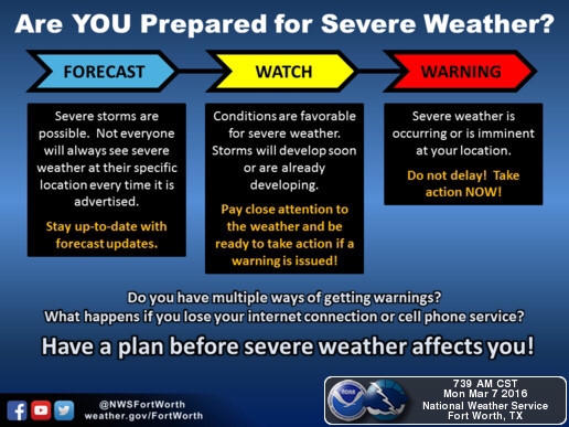
Here are some safety tips to help you prepare for severe weather! Please take the time to read this information and feel free to share amongst friends and family members! Image courtesy: NWS Fort Worth, TX.
Another update will be posted this evening. Stay tuned for more information. Make sure to follow our Facebook page, Twitter page and Instagram page for more updates and watches and warnings that may be issued.
 RSS Feed
