Rain Returns to North Texas
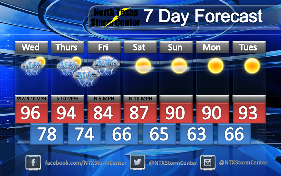
Will you need an umbrella this week? Will you potentially need to cancel any outdoor plans this week? Find out in this blog post as we break down the timing! 
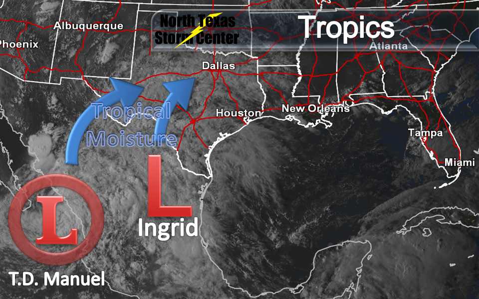
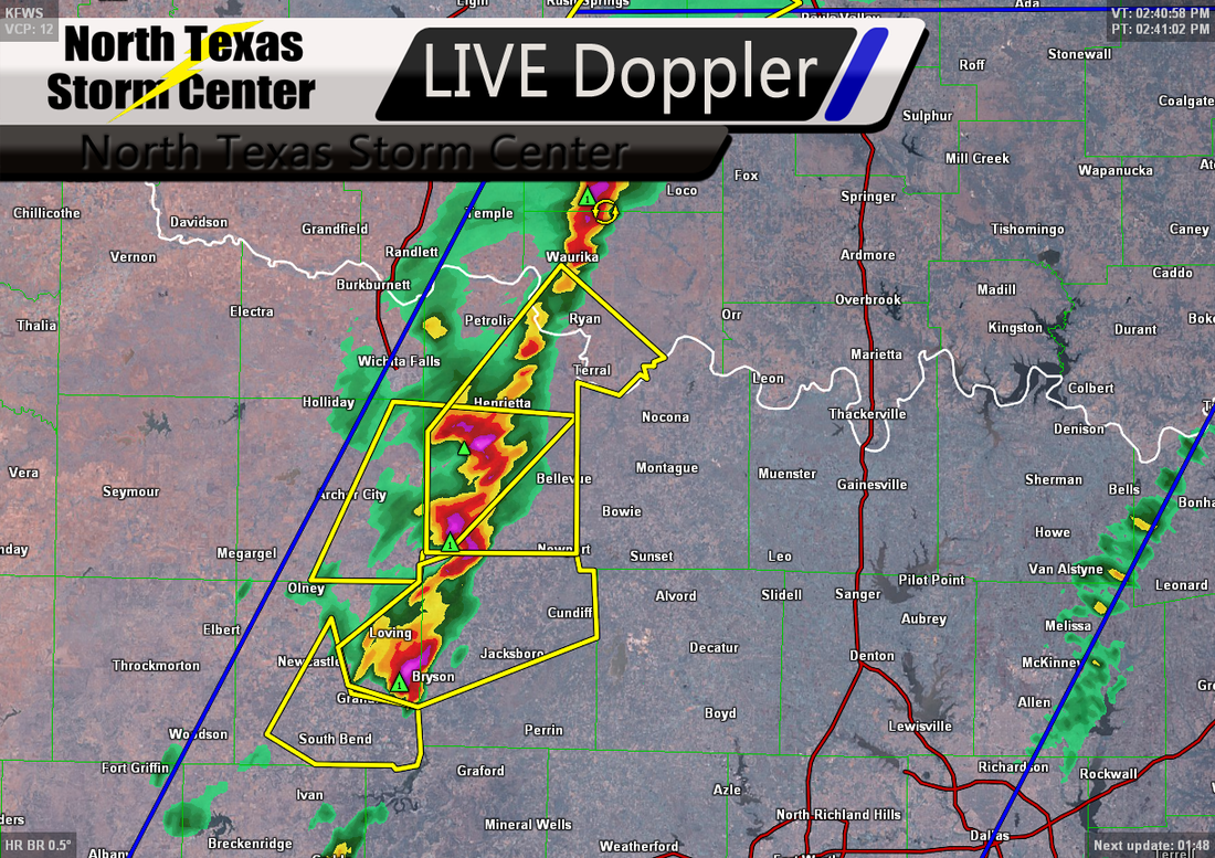
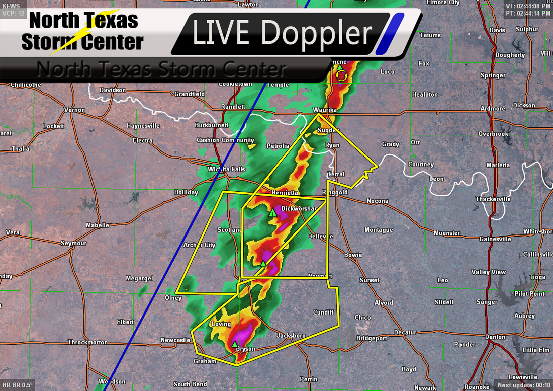
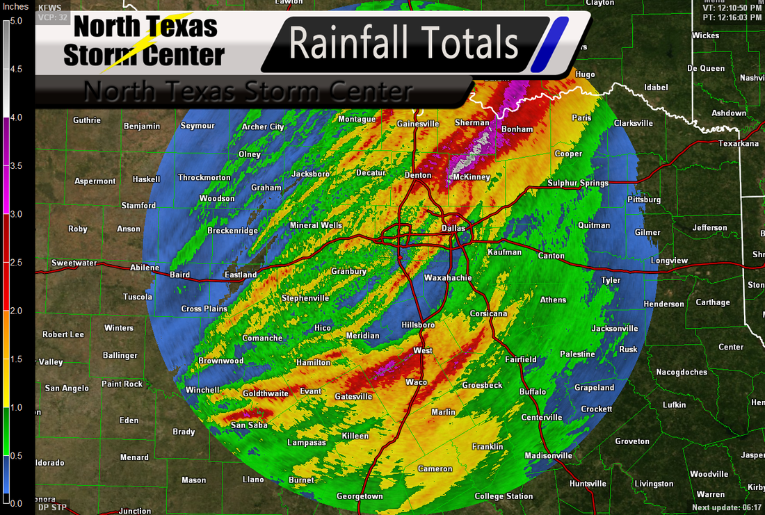
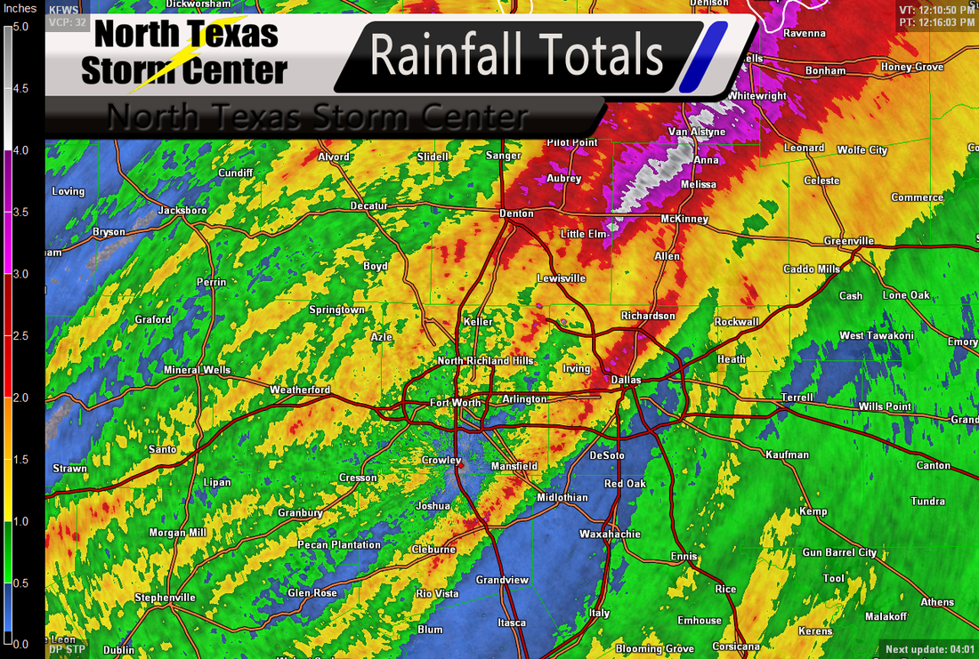
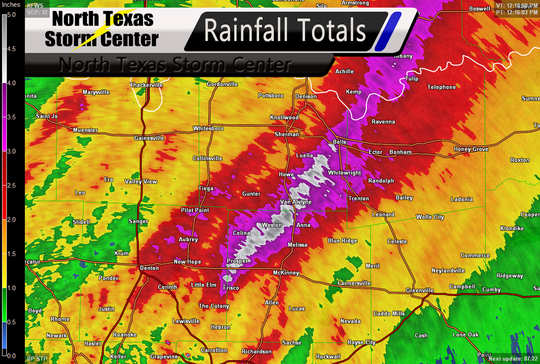
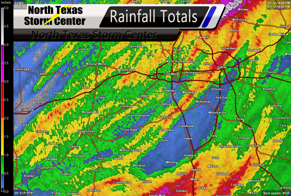
Right now, former Hurricane Ingrid and Tropical Depression Manuel look like they may cause a dampening in North Texas by the end of this work week as we see them sending some topical moisture to North Texas. 
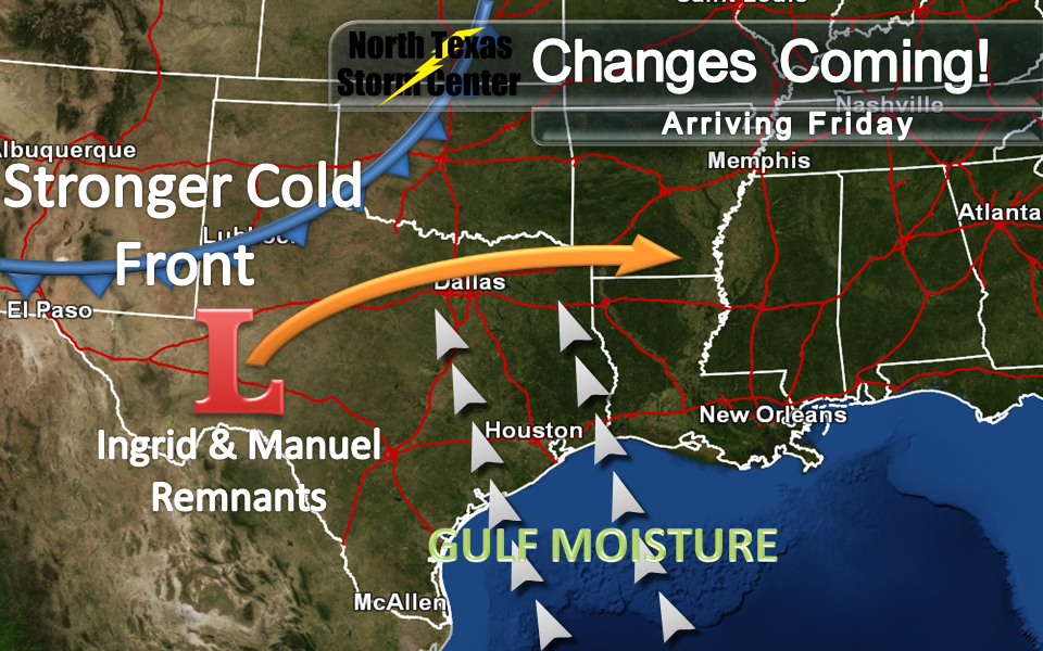
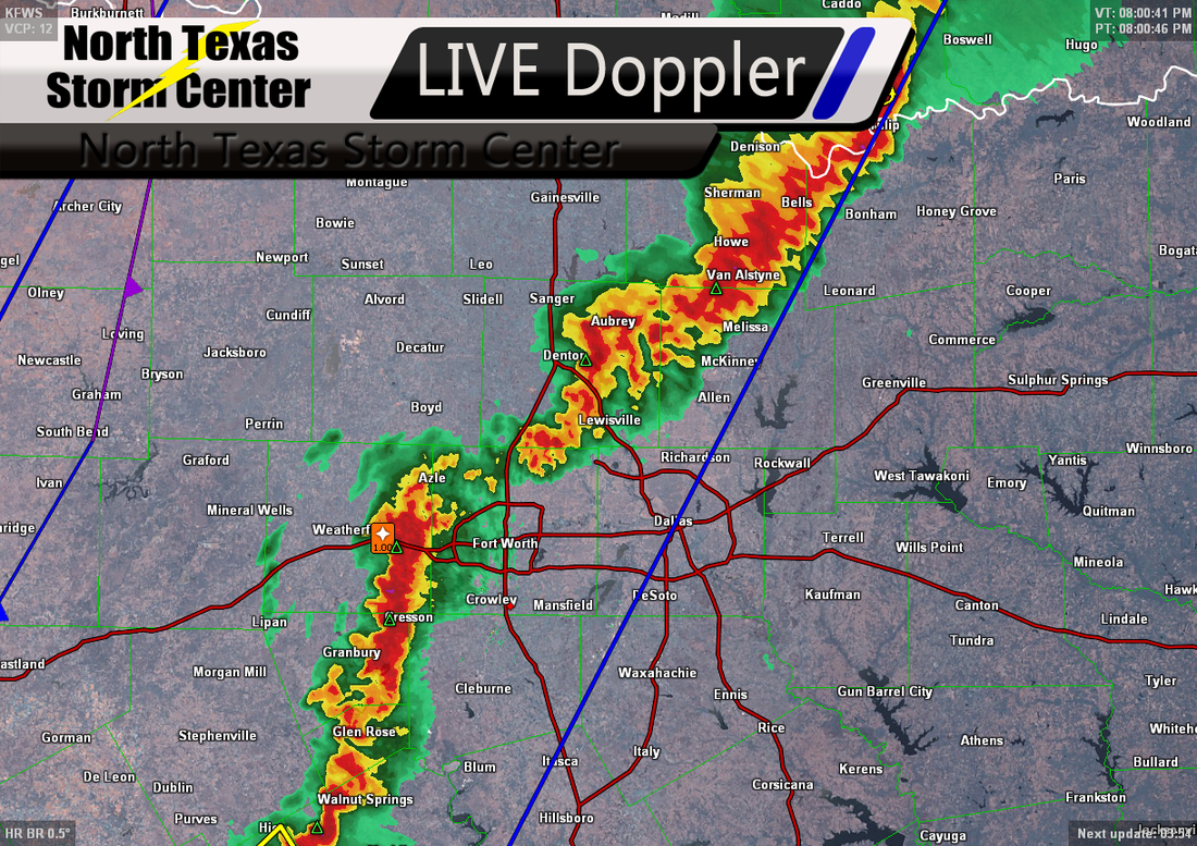
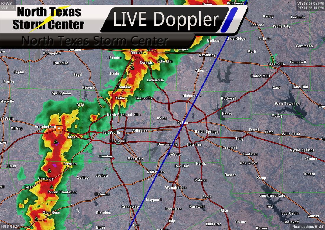
By Thursday into Friday, we will begin to see Gulf moisture combine with a cold front as well as the remnants of Ingrid and Manuel and increase our chances of rain and thunderstorms to around 50%-60%. 
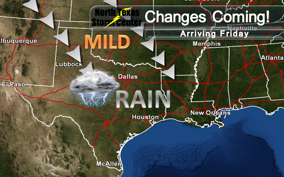
Once the cold front moves through and we begin to clear out by Saturday morning, we will begin to see mild temperatures. Below is your forecast for the next 7 days!
0 Comments
As we all know, tomorrow is Independence Day, the day that our great nation of the United States declared independence from Great Britain on July 4, 1776. To celebrate this holiday, many will be spending time with their families, going to parades, having barbecues, going to carnivals, having picnics, going to concerts and baseball games and MUCH more across North Texas tomorrow, but what will the weather be like for tomorrow's celebrations? Tomorrow, we expect a nice high of around 91 and mostly sunny skies across North Texas and winds South South East at about 5 miles per hour. Click here for a list of Fourth of July Events across North Texas.
This next week is looking like it will be a pleasant week across North Texas. We will be seeing some unseasonably low temperatures in the upper 80's and low 90's across North Texas this week. We will also be seeing our low temperatures overnight dipping down into the mid 60's and low 70's. Below is a more detailed graphic 7-Day Forecast:
A pleasant week is ahead for North Texas; for the first time this year, we expect to hit 90 degrees at DFW during this week, we expect to see some mild temperatures as we wake up this week, we could see some rain chances later this week and even during the beginning of next week. Below is your 7-Day Forecast: 7-Day Forecast for 5-14-13 through 5-20-13 Monday Night - Partly cloudy, with a low around 61. South wind 10 to 15 mph. Tuesday - Mostly sunny, with a high near 85. South southwest wind 10 to 15 mph, gusts as high as 20 mph. Tuesday Night - A 40% chance of showers and thunderstorms, mainly after 1 am. Mostly cloudy, with a low around 66. South wind around 15 mph, with gusts as high as 25 mph. Wednesday - A 50% chance of showers and thunderstorms. Mostly cloudy with a high near 80. South wind 15 to 20 mph, gusts as high as 25 mph. A FEW storms may be on the strong side, possibly even severe, however, widespread severe weather is not expected across North Texas on Wednesday as of now. Wednesday Night - A 30% chance of showers and thunderstorms. Mostly cloudy, with a low around 66. South southeast winds around 15 mph, gusts as high as 25 mph. Thursday - Partly sunny, with a high near 83. Winds south southeast at 10 to 15 mph, gusts as high as 20 mph. Thursday Night - Mostly cloudy, with a low around 67. Winds south southeast at 10 to 15 mph, gusts as high as 20 mph. Friday - Partly sunny, with a high near 86. South wind 10 to 15 mph, gusts as high as 20 mph. Friday Night - Partly cloudy, with a low around 68. South wind around 15 mph, gusts as high as 20 mph. Saturday - Partly sunny, with a high near 88. Saturday Night - Partly cloudy with a high around 68. Sunday - A 20% chance of showers and thunderstorms. Partly sunny with a high near 87. Sunday Night - A 20% chance of showers and thunderstorms. Mostly cloudy, with a low around 69. Monday - Mostly sunny, with a high near 87. Good morning, and happy Mother's Day to all you mothers out there! Looks like we're going to have a beautiful day in store for you mothers to spend with your families today. Today we expect to see mostly sunny skies throughout the day, with a high topping out at around 79. Day-part forecast: Morning: Mostly sunny, with temperatures in the mid 60's. Midday: Mostly sunny, with temperatures in the low 70's. Afternoon/Evening: partly cloudy, with temperatures in the upper 70's to low 80's. A diagram of tornado alley's rough location (red) Well, it's that time of year, Spring! While it is an absolutely amazing time to watch all of the new plant life bloom, it is also is a time when we have to watch the skies as well. As many of us North Texans know, North Texas can be a very dangerous place come spring time.. mainly because we're in a region know as 'Tornado Alley'. In case you might not know what Tornado Alley is, Tornado Alley is the region in the United States where most of the tornadoes reported annually occur. North Texas just happens to lie right inside of 'Tornado Alley'. Tornado Alley includes the states of Texas, Kansas, Oklahoma, Nebraska, Iowa, Illinois & Missouri. The main reason that 90% of tornadoes hit this region of the U.S because cold, dry air from Canada and the Rocky Mountains meets warm, moist air from the Gulf of Mexico and hot, dry air from the Sonoran Desert, which causes atmospheric instability, heavy precipitation, and many intense thunderstorms. Since I live in Tornado Alley, what preparedness actions should I take?Stock photo of extensive tornado damage to a home. Well, the first thing to note is that tornadoes don't jest happen in the Spring. Tornadoes can occur any time of day, any day of the year so you need to make sure that you are prepared and stay prepared year round and be ready to act at a moments notice. The first preparedness action you should take for a tornado is that you have a safe place to go should a tornado occur. The safest place to be is an an underground shelter, basement or a safe room, however, if there is no safe room, underground shelter or basement available then you should go to a small, windowless interior room or hallway on the lowest level of a sturdy building. "What if I live in a mobile home?" Well here's the thing about mobile homes, they are not safe at all from tornadoes. They can easily be picked up and thrown around like a toddler throwing his toy cars about. If you are in a mobile home during a tornado, abandon it and go to the nearest sturdy building or shelter immediately. "But, what if I'm caught outside during a tornado?" If you are caught outside in the event of a tornado, try to find a sturdy building, storm shelter or basement to seek shelter in. If you cannot quickly walk to a shelter, immediately get into a vehicle, buckle your seatbelt and try to drive to the closest sturdy shelter. If flying debris occurs while you are driving, pull over and park. You have the following options as a last resort; a. stay in your vehicle with the seatbelt on. Put your head down below the windows, covering your hands with a blanket if possible. or b. if you can safely get noticeably lower than the level of the roadway, exit your car, and lie in that area, covering your head with your hands.. your choice should be driven by your specific circumstances. Just remember, to always have a plan in place as severe weather and tornadoes can strike ANY TIME, ANY DAY OF THE YEAR. Severe Weather Preparedness Guides Below I have attached links to some severe weather safety guides from The Red Cross and The National Weather Service. Click 'read more' to view the guide links.
A radar frame indicating large hail over Salesville, TX near Mineral Wells The skies opened up over many of us here in North Texas yesterday after midday dropping some very much needed rain for us. Thankfully, the storms stayed out of severe limits as they reached the Dallas-Fort Worth Metroplex, but for others we can't say the same. The storms dropped some large hail over portions of North Texas. Some of the reported hail as large as egg sized. Wise county had numerous reports of hail between 0.88" to 1.75" in diameter. Dallas county had a few reports of hail between 0.75" and 1.75" in diameter. Jack county had some reports of hail 0.75" to 1.75" as well as Montague county. A regional view of the rainfall totals over North Texas. As well as the hail North Texas saw yesterday, we saw some pretty nice rainfall totals. The image to the left shows rainfall totals across North Texas. In far North-Western portions of North Texas, we saw rainfall totals ranging between .5" to 1". In South-Western portions of North Texas, we saw rainfall totals ranging between .5" to 2.5". In the Dallas-Fort Worth Metroplex, we saw rainfall totals ranging between .5" to 4". Along the Red River, in a line from Muenster to Bonham, we saw anywhere from 2" to 5", however the 5" was mostly around Van Alstyne. In South-Western portions of North Texas, we totals around 1" of rainfall. Notice the blue area though between DeSoto to Meridian, no that's not a gap in our data, they really did only see between a trace to .5" of rainfall from these storms yesterday. Below I have posted a gallery of a few of the radar images from yesterday as well as rainfall totals as of this morning. A few of the radar images & rainfall totals from yesterday's storms. |
Categories
All
|