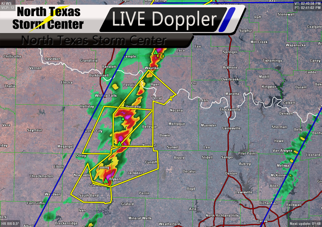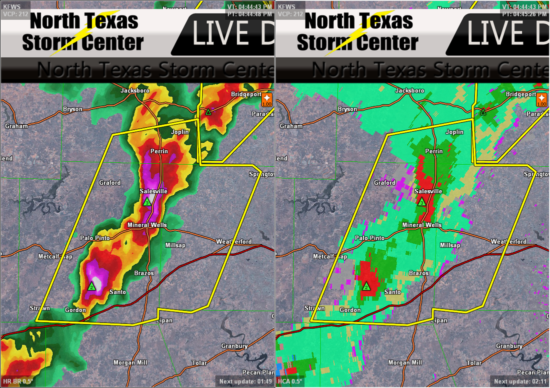
A radar frame indicating large hail over Salesville, TX near Mineral Wells
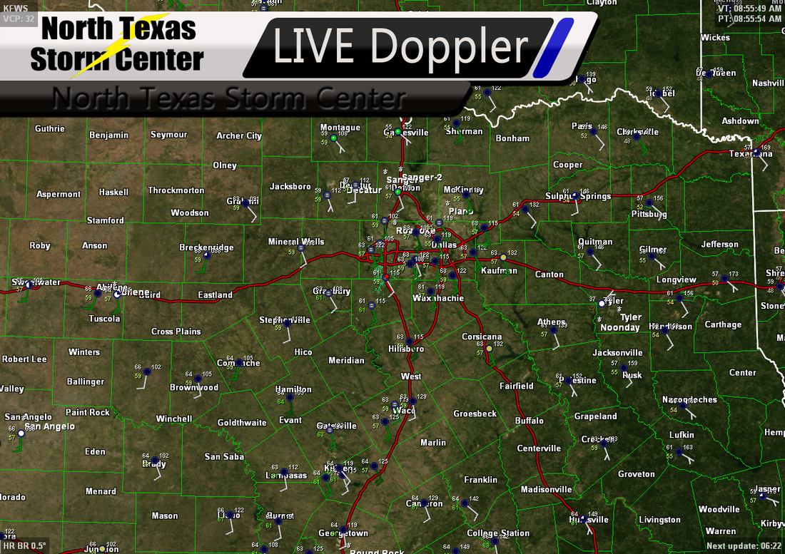
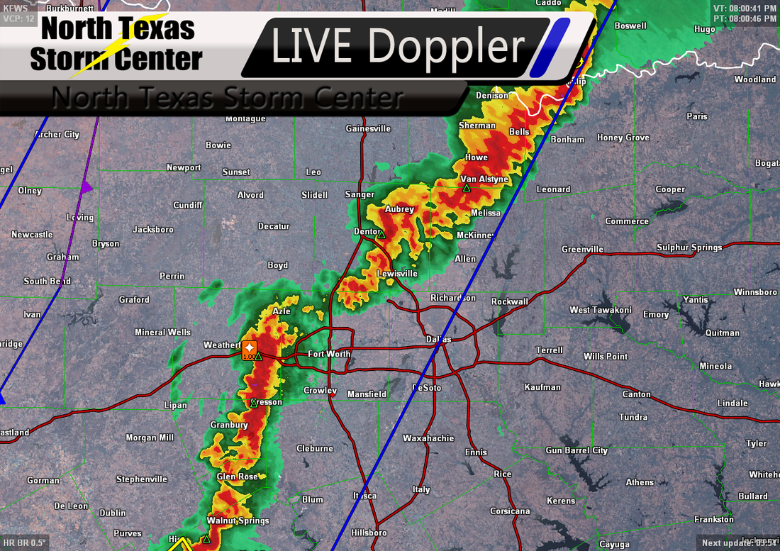
The skies opened up over many of us here in North Texas yesterday after midday dropping some very much needed rain for us. Thankfully, the storms stayed out of severe limits as they reached the Dallas-Fort Worth Metroplex, but for others we can't say the same. The storms dropped some large hail over portions of North Texas. Some of the reported hail as large as egg sized. Wise county had numerous reports of hail between 0.88" to 1.75" in diameter. Dallas county had a few reports of hail between 0.75" and 1.75" in diameter. Jack county had some reports of hail 0.75" to 1.75" as well as Montague county.
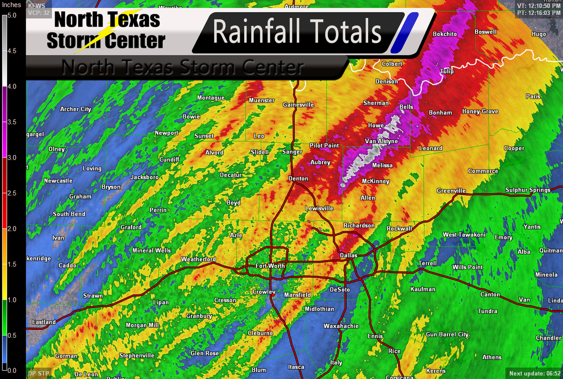
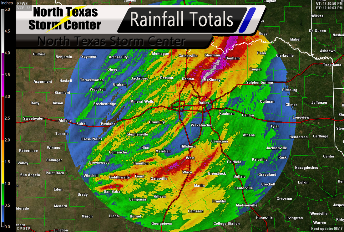
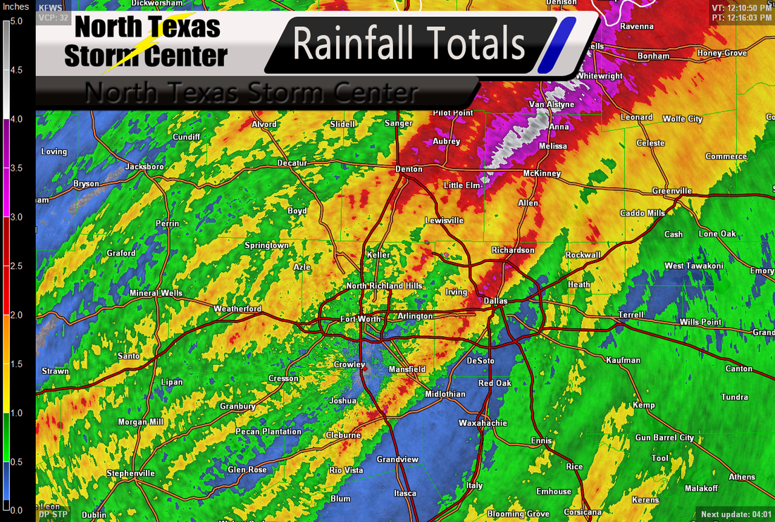
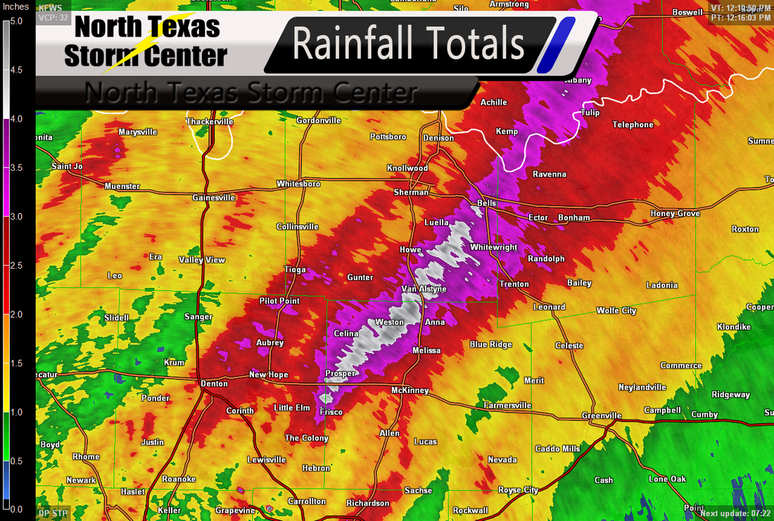
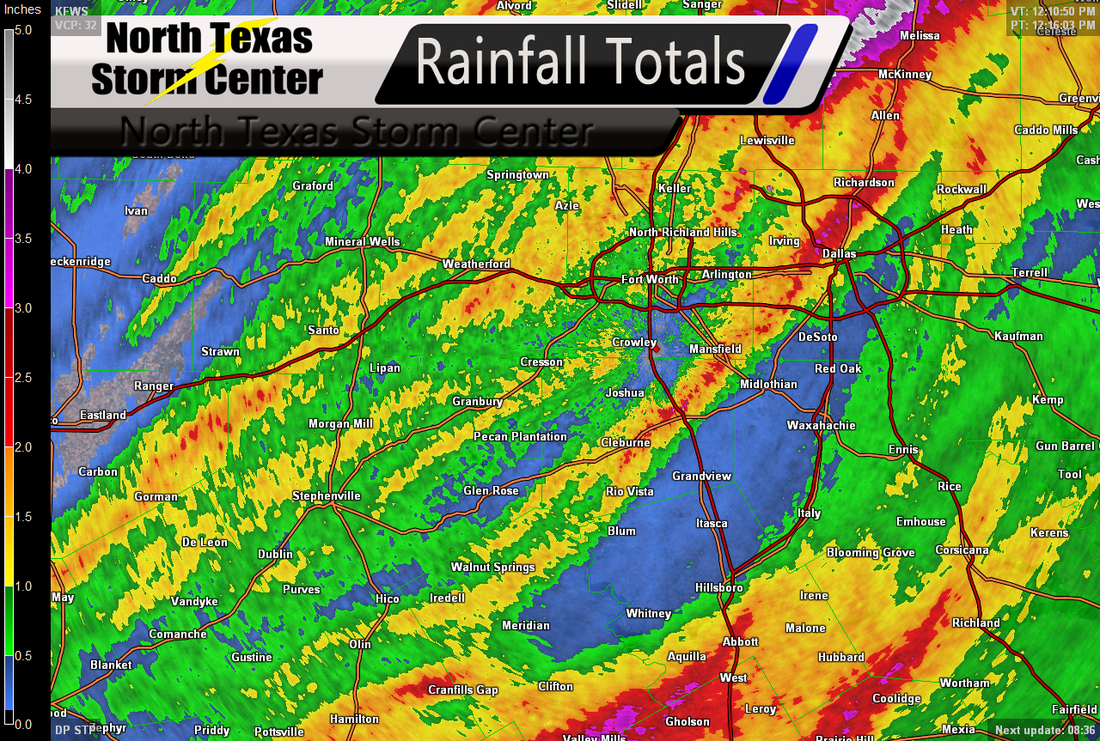
A regional view of the rainfall totals over North Texas.
As well as the hail North Texas saw yesterday, we saw some pretty nice rainfall totals. The image to the left shows rainfall totals across North Texas. In far North-Western portions of North Texas, we saw rainfall totals ranging between .5" to 1". In South-Western portions of North Texas, we saw rainfall totals ranging between .5" to 2.5". In the Dallas-Fort Worth Metroplex, we saw rainfall totals ranging between .5" to 4". Along the Red River, in a line from Muenster to Bonham, we saw anywhere from 2" to 5", however the 5" was mostly around Van Alstyne. In South-Western portions of North Texas, we totals around 1" of rainfall. Notice the blue area though between DeSoto to Meridian, no that's not a gap in our data, they really did only see between a trace to .5" of rainfall from these storms yesterday. Below I have posted a gallery of a few of the radar images from yesterday as well as rainfall totals as of this morning.