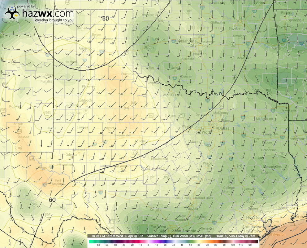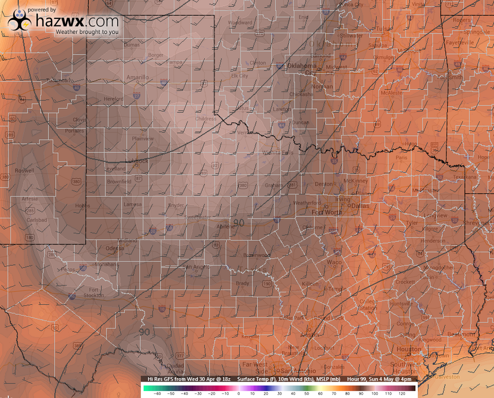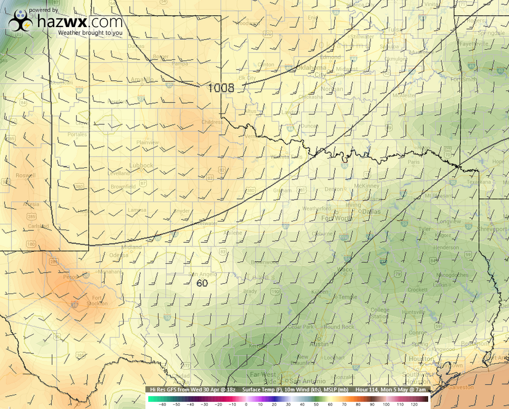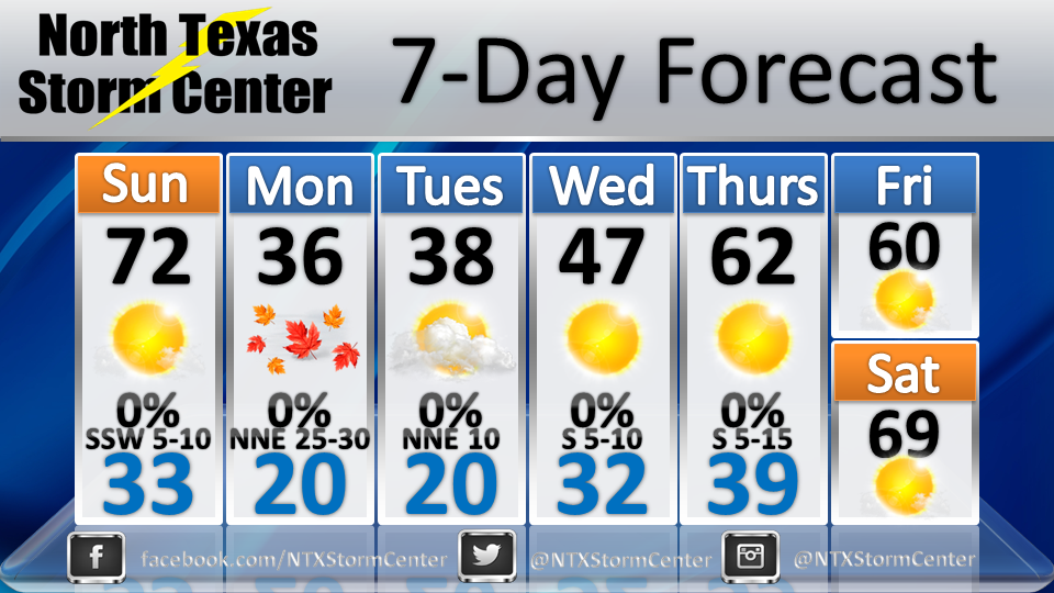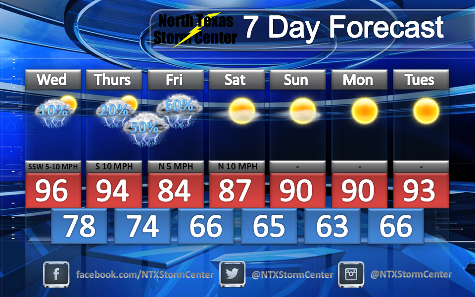
Good morning everyone! Here's a quick update on the possible severe storms this week. Images and forecasts are courtesy of the NWS Fort Worth.
Today (Tuesday)
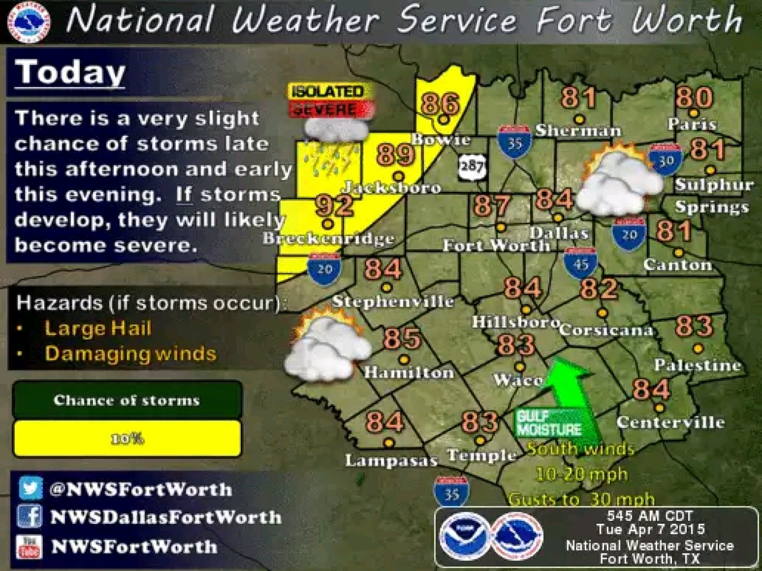
Courtesy NWS Fort Worth - Some isolated thunderstorms are possible late this afternoon and early this evening along and northwest of a Cisco to Bowie line. IF storms develop, they will likely become severe with large hail and damaging winds being the primary hazards. Cloud-to-ground lightning and heavy rain may also accompany these storms. Otherwise, expect warm, breezy and humid conditions today. Temperatures will climb into the 80s at most locations and a few spot across the northwest will reach the lower 90s.
Courtesy NWS Fort Worth - Some isolated thunderstorms are possible late this afternoon and early this evening along and northwest of a Cisco to Bowie line. IF storms develop, they will likely become severe with large hail and damaging winds being the primary hazards. Cloud-to-ground lightning and heavy rain may also accompany these storms. Otherwise, expect warm, breezy and humid conditions today. Temperatures will climb into the 80s at most locations and a few spot across the northwest will reach the lower 90s.
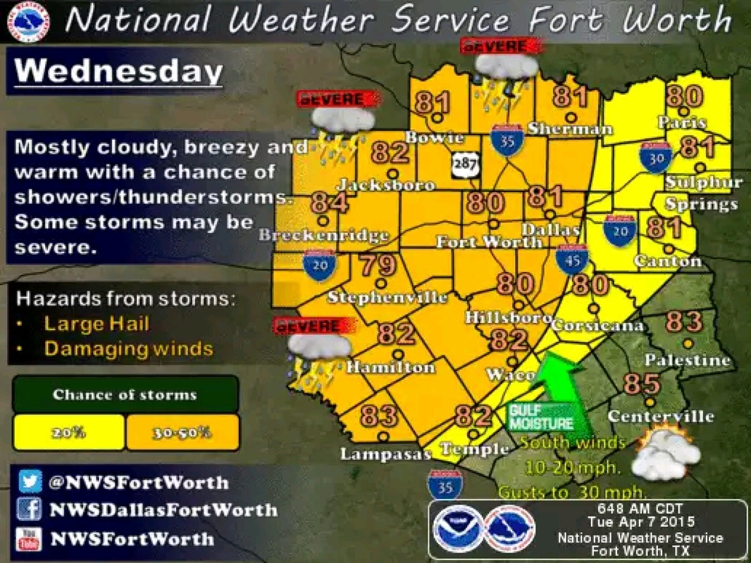
Wednesday
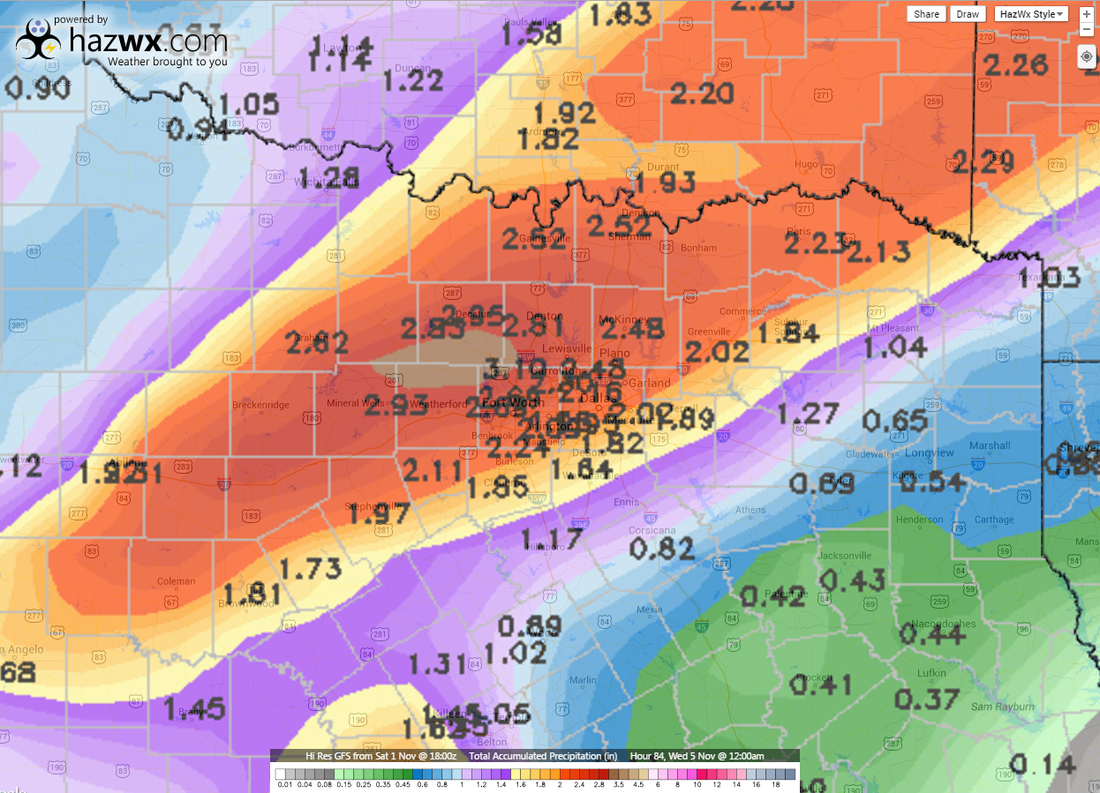
Courtesy NWS Fort Worth - There will be a chance of showers and thunderstorms across much of North and Central Texas Wednesday with the best chances being along and west of I-35. Some strong to severe storms are possible. The main hazards with these storms will be from large hail, damaging straight-line winds and lightning. A heavy rain threat will also be possible beneath any slow-moving thunderstorms.
Courtesy NWS Fort Worth - There will be a chance of showers and thunderstorms across much of North and Central Texas Wednesday with the best chances being along and west of I-35. Some strong to severe storms are possible. The main hazards with these storms will be from large hail, damaging straight-line winds and lightning. A heavy rain threat will also be possible beneath any slow-moving thunderstorms.
Thursday
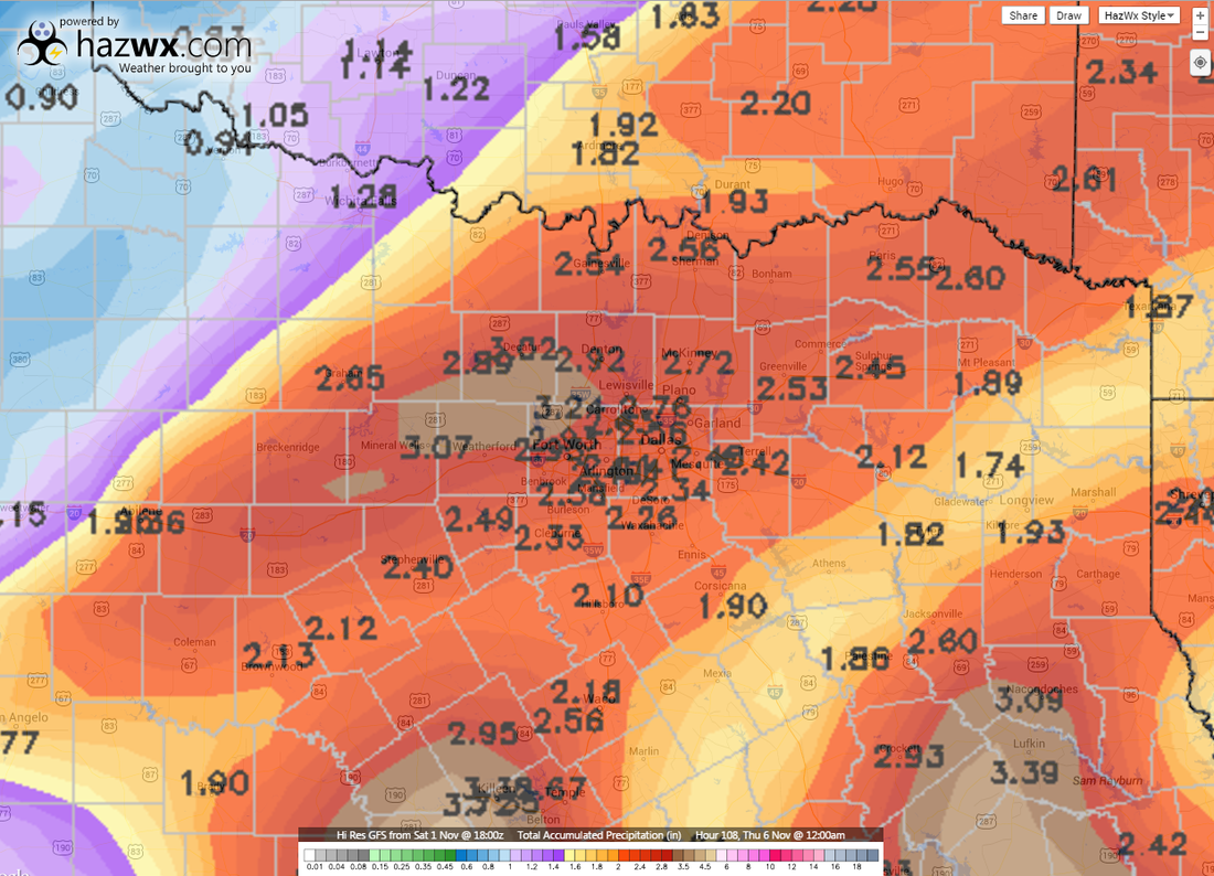
Courtesy NWS Fort Worth - Chances of showers and thunderstorms will continue on Thursday as an upper level trough translates the Central and Southern Plain, and a weak cold front pushes through the region. The best chances for precipitation will likely occur across the eastern half of the region. A few storms should become severe with large hail and damaging winds. Storms should end from west to east Thursday evening.
Courtesy NWS Fort Worth - Chances of showers and thunderstorms will continue on Thursday as an upper level trough translates the Central and Southern Plain, and a weak cold front pushes through the region. The best chances for precipitation will likely occur across the eastern half of the region. A few storms should become severe with large hail and damaging winds. Storms should end from west to east Thursday evening.