There will be a threat for strong/severe thunderstorms this afternoon/evening across North Texas. After this morning's round of storm clears out, the atmosphere is expected to destabilize East of the I-35 corridor and become favorable for the development of strong to severe thunderstorms this afternoon and evening. Additional thunderstorms are expected to develop along the dryline which will be located West of the I-35 corridor. Storms across North and Central Texas this afternoon and evening will likely be severe and will be capable of producing large hail, damaging winds and a few tornadoes possible. The threat for storms, possibly severe, will continue as a front overtakes our region and a dryline moves east across the region.
Afternoon/evening Storms
Courtesy NWS Fort Worth, Texas: As most of the morning shower and thunderstorm activity shifts east of Interstate 35 this afternoon, the atmosphere will destabilize during the peak heating hours of the afternoon across the rest of the forecast area. Additional thunderstorms are expected to develop along a dryline, which will be west of Interstate 35/35W. Some storms across all of North and Central Texas this afternoon and evening will be severe with large hail, damaging winds and a few tornadoes possible. The threat for storms, possibly severe, will continue tonight as a front overtakes the dryline moves east across the region.
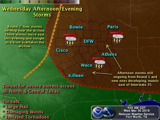
Image courtesy: NWS Fort Worth, Texas
ENHANCED RISK Today, includes DFW Metroplex
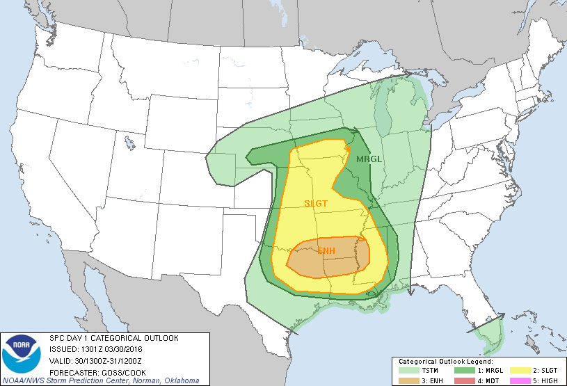
Image courtesy: NWS SPC
Monitoring for Thunderstorms
Courtesy NWS Fort Worth, Texas: Morning satellite imagery indicates a few breaks in the clouds west of Interstate 35. This is an area of increasing atmospheric instability. We are closely monitoring this area for thunderstorm development through midday.
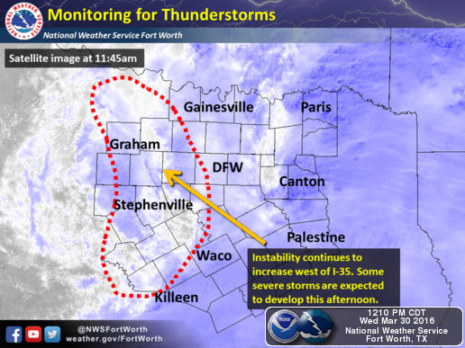
Image courtesy: NWS Fort Worth, Texas
Severe Weather Preparedness

Image courtesy: NWS Fort Worth, Texas