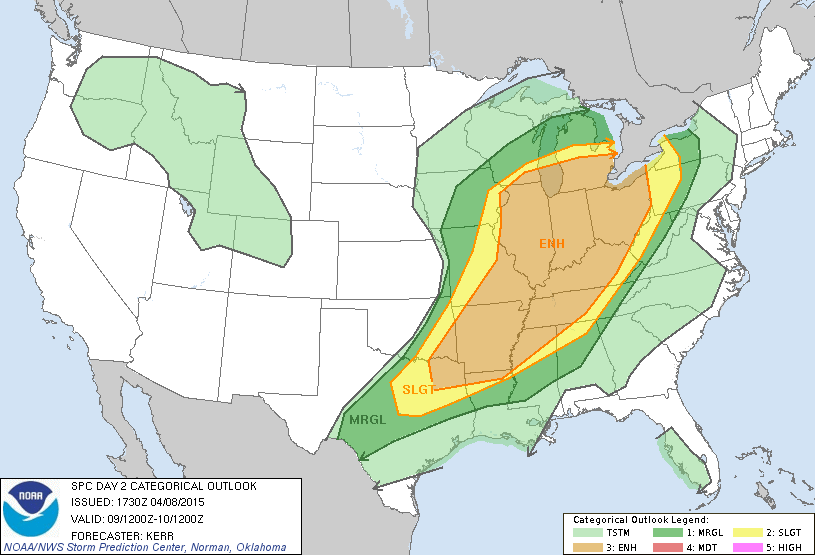
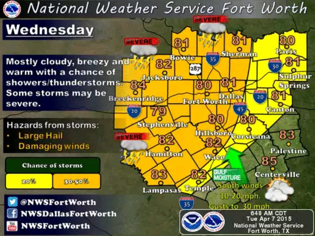
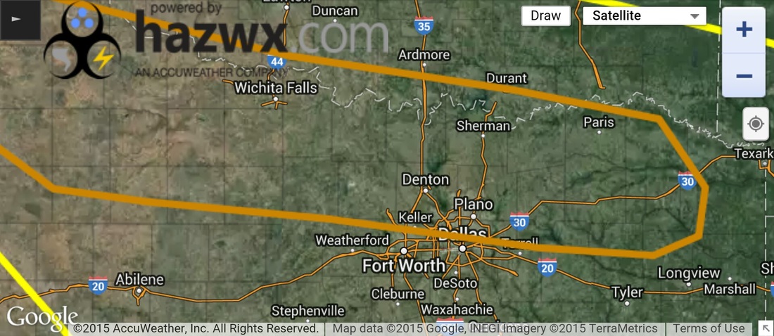
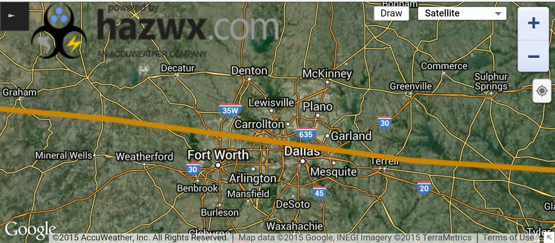
Good morning everyone, wanted to give a quick update on what to expect from today's storms. As of this morning, the "enhanced" risk region no longer covers most of North Texas, and instead just covers the Red River counties down in to Dallas and Tarrant, but only a small sliver in the extreme North of those cointies, leaving the rest of North Texas under a "Slight" risk. However, this does not mean we can let our guard down for counties outside of the "Enhanced" risk areas, folks inside of the "Slight" risk area need to pay close attention as well.
The brownish orange colored outline represents the "Enhanced" risk area, the yellow colored outline represents the "Slight" risk area.
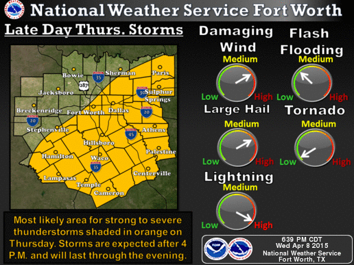
Threats today may include:
• Large Hail
• Frequent Lightning
• Large Hail
- Damaging Winds
- A Few Tornadoes
• Frequent Lightning
Forecast Timing for today's storms is between 4 PM and 12 AM.
SPC Convective Outlook for Wednesday April 22, 2015.
SPC Convective Outlook for Wednesday April 22, 2015.
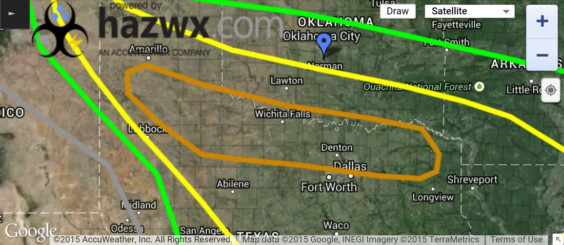
SPC Convective Outlook for Wednesday April 22, 2015.