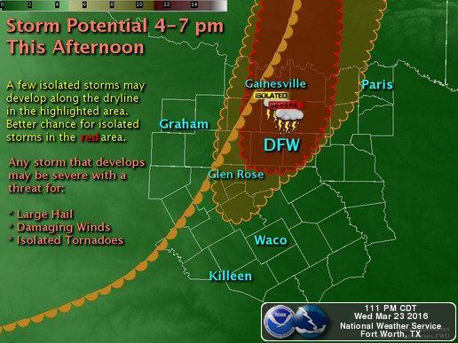
Image courtesy: NWS Fort Worth, TX
Courtesy NWS Fort Worth, TX: A dryline is expected to mix eastward towards the I-35 corridor late this afternoon. A cap, layer of warm air aloft, is expected to suppress most afternoon convection; however, an isolated storm or two will be possible mainly east of I-35. If storms develop, they may become strong to severe , with large hail and damaging winds being the primary threats. A tornado or two cannot be ruled out. In addition, a Critical Fire Weather Threat is expected to develop behind the dryline along and west of the Highway 281 corridor.
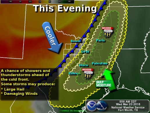
Image courtesy: NWS Fort Worth, TX
A cold front will overtake the dryline this evening, leading to an increase in thunderstorm coverage after about 7pm this evening. Some storms along the cold front could be strong to severe, with damaging winds and hail being the primary threats.
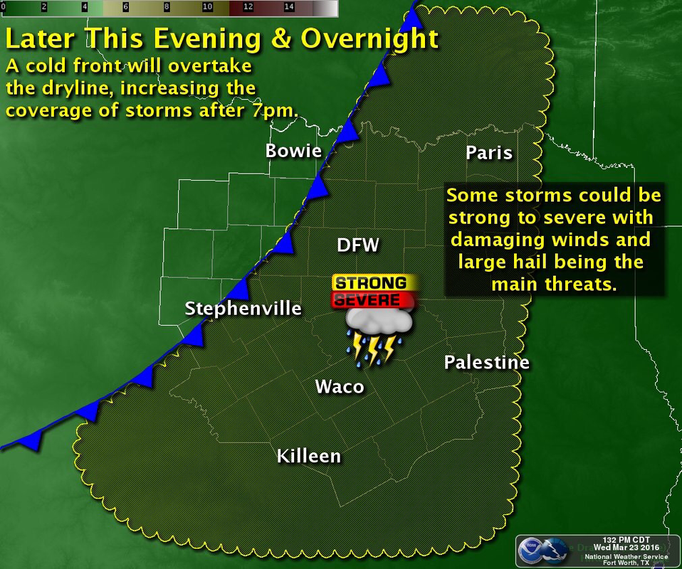
Image courtesy: NWS Fort Worth, TX
Courtesy NWS Fort Worth, TX: Coverage of storms should increase after 7pm & persist overnight. Some strong/severe storms possible.
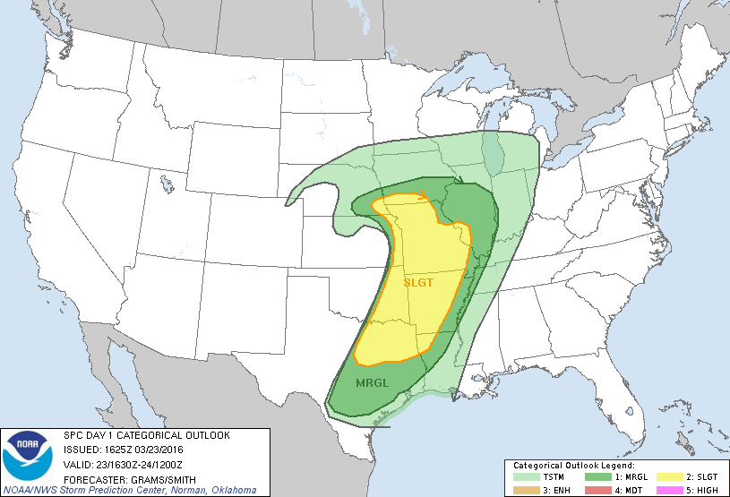
Image courtesy: NWS SPC Norman, OK
The National Weather Service Storm Prediction Center in Norman, Oklahoma has issued a SLIGHT risk for severe thunderstorms across North Texas, including the DFW Metroplex, this afternoon and evening. Stay tuned this afternoon and evening for further information and updates, and watches and warnings if they are issued.