Good morning everyone! Here's the latest on tomorrow's storms. The NWS SPC had placed North Texas, including the DFW Metroplex under an ENHANCED risk for tomorrow, Tuesday April 26, 2016. Potential threats include; tornadoes…some strong, VERY large hail and damaging winds.
What to know
- Timing: afternoon into the night time hours
- Tornadoes…some strong could be possible
- VERY large hail possible
- Damaging winds possible
- ANY storms that do form will be capable of quickly becoming severe
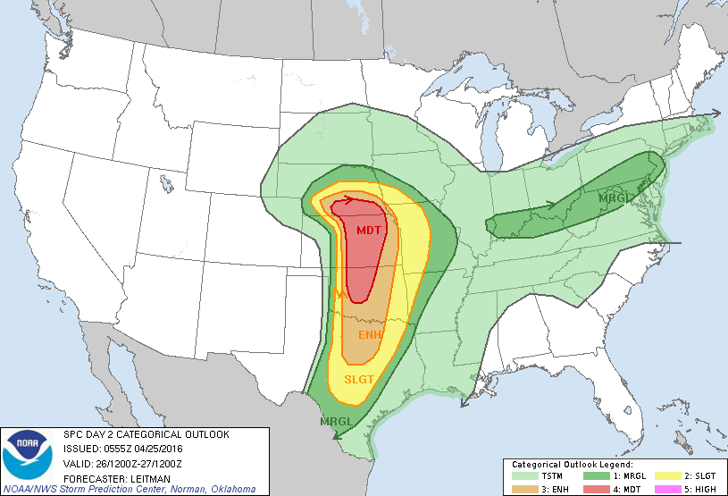
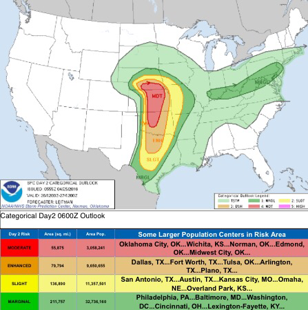
SPC Day 2 Categorical Outlook
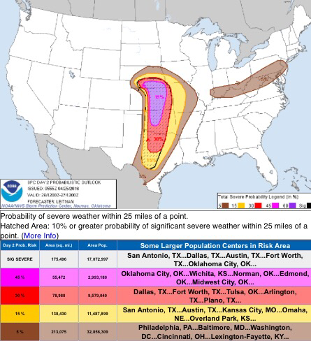
SPC Day 2 Probablistic Outlook

Severe Threat Increasing Tuesday
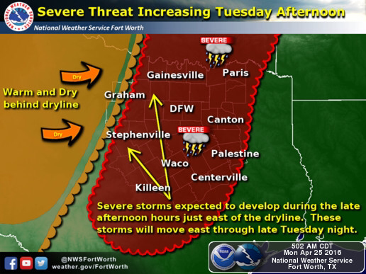
Courtesy NWS Fort Worth: The severe weather threat will start by late Tuesday afternoon, as a strong upper trough approaches from the west. This system will allow a dryline to set up well west of Interstate 35 Tuesday afternoon. Thunderstorms are expected to develop along and east of the dryline late Tuesday afternoon and move east through the late evening hours. Storms that develop during this time are expected to be severe with large hail and damaging winds. There is some threat for tornadoes but at this time it does not appear that conditions will be optimal for tornadoes. We will continue to monitor the tornado threat closely over the next 24-36 hours.
Be sure to remain WEATHER AWARE tomorrow, as any storm that forms tomorrow may quickly become severe. There will be more updates throughout today and into tomorrow. Stay tuned for more information and the latest updates!